Monitoring the Global Water Cycle and Climate Change – its Application to the Society
Japan Aerospace Exploration Agency (JAXA)
Outline
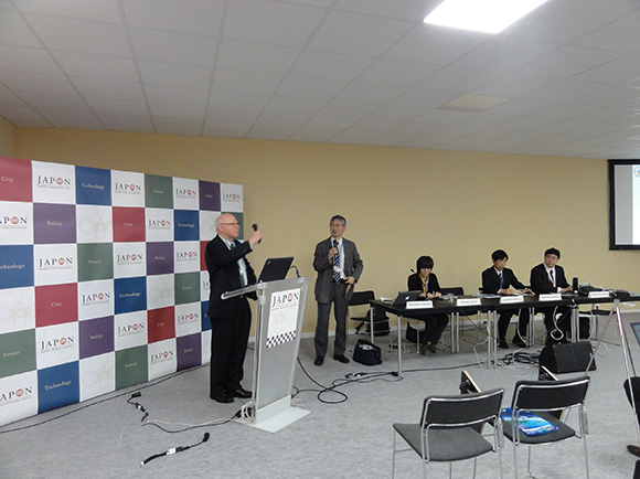
Water is indispensable for human life but it is now being affected by climate change. Both the increase and the decrease of rainfall and snowfall may cause water-related disasters, such as floods and droughts, which affect to our daily life. Since changes in the global water cycle could shake the foundation of today’s sustainable society, understanding the status and variations of the water cycle on a global scale is one of the keys to prevent such a disaster. Japan Aerospace Exploration Agency (JAXA) has developed “JAXA Global Rainfall Watch (GSMaP)” that is offering the hourly global rainfall map in a near-real-time basis by merging multi-satellite data. By combining GSMaP data and flood analysis systems, it is possible to provide early warning to water-related hazards that have the largest number of victims and incidents among natural hazards. In this side event, we will introduce data from European and Japanese Earth observation satellites and examples of their application to respond to societal problems. We also discuss how we can maintain monitoring and predicting the variations of global water cycle in the long-term.
Program
-
- Monitoring of the Water Cycle and Climate Variation by the Earth Observation Satellites
- Ms. Misako Kachi, Manager for GCOM-W Research, Earth Observation Research Center, JAXA, Japan
-
- Monitoring and Understanding Our Environment through Satellite Remote Sensing
- Dr. Alexander E. MacDonald, OAR Chief Science Advisor, Director of Earth System Research Lab, National Oceanic and Atmospheric Administration (NOAA), U.S.
-
- The Arctic Sea Ice Monitoring and Climate Variation
- Prof. Hiroyuki Enomoto, Vice Director-General, National Institute of Polar Research, Japan
-
- Application of Satellite Rainfall Monitoring in Flood Management of Indus River
- Mr. Takahiro Konami, Programme Specialist, Hydrological Systems and Water Scarcity Section, International Hydrological Programme (IHP), UNESCO
-
- Q&A
Summary
In this side event, the Japan Aerospace Exploration Agency (JAXA) and the National Ocean and Atmosphere Administration (NOAA) introduced current and future earth observation satellites which observe water cycle from space. JAXA has been operating “GCOM-W” satellite, monitoring El Niño/La Niña, soil moisture, sea ice in arctic area, etc. NOAA operates polar orbit satellites as well as geostationary satellites and they use data for long term weather forecast and hurricane prediction in the collaboration with Europe and Japan. International cooperation is very important and we confirmed that the importance of combining data from multiple satellites or other data sources.
In addition, we had reports on arctic sea ice monitoring and flood management in Pakistan from data users. Microwave sensors such as AMSR-2 on GCOM-W have advantages to monitor arctic sea ice because arctic area is often covered by cloud and night time is long during winter. To monitor polar region is very important for better understanding climate change. On the other hand, a project in Pakistan use satellite data for flood management. JAXA combines the data from multiple satellites, analyze precipitation information, and opens it to the public freely in real time through “Global Satellite Map of Precipitation (GSMaP)”.
Based upon the current satellites, we confirmed the importance of considering improvement of functions of next generation satellite.
Key Messages
Research on arctic region where climate change occurs earlier than others is important to understand its impacts. Satellite data including archive of past decades can provides important information on water cycle in arctic region.
In addition, by combining data from multiple satellites, JAXA provides precipitation information in near real time which is useful for flood management.
Frequent global observation through international collaboration and its continuity are important to observe water cycle by satellites. Since current global climate models provides higher resolution, it is also important to improve functions of satellite to provide data which will fit to the models.
Photograph
Reporters
Naoko Matsuo, Japan Aerospace Exploration Agency (JAXA)


